
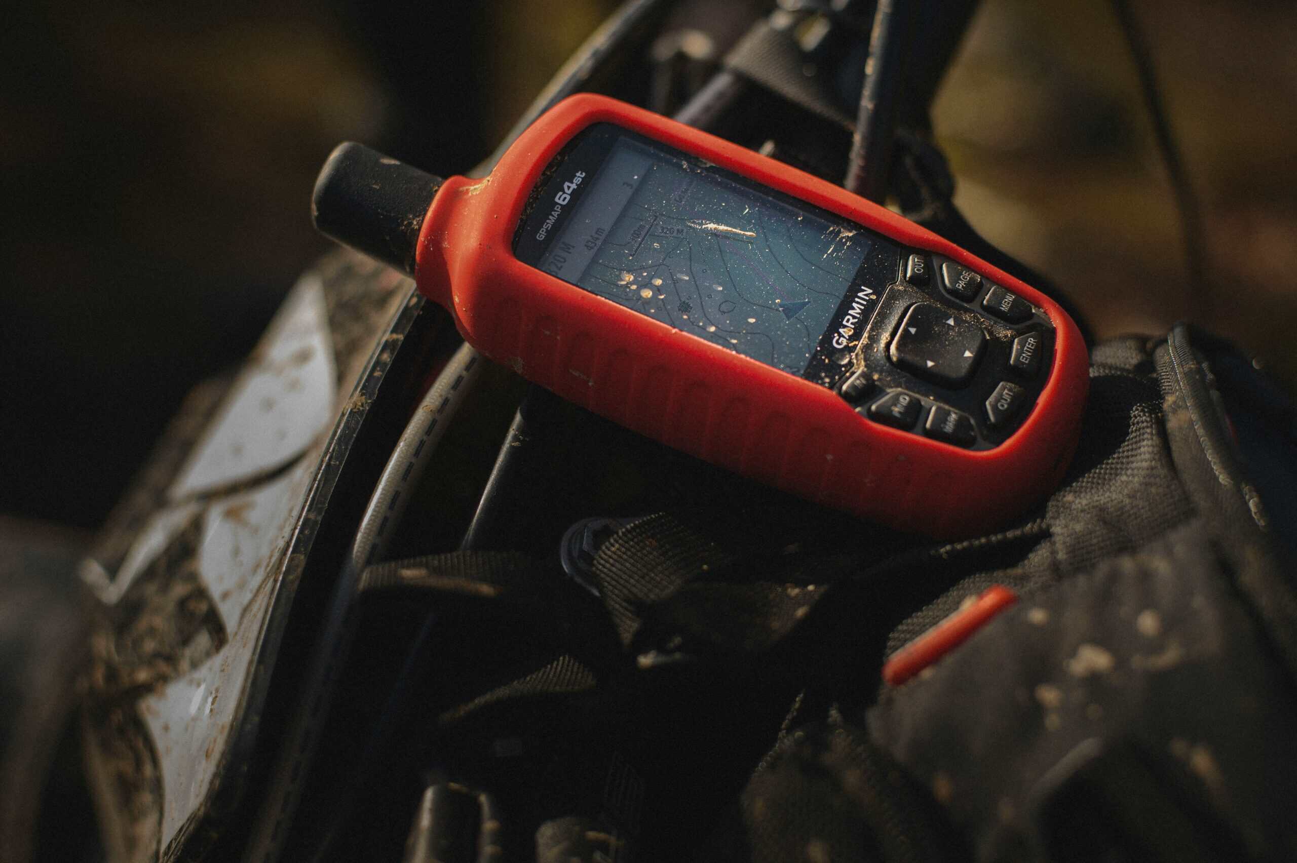
A handheld GPS earns its place in a pack when your phone cannot be trusted to last the day or hold a fix. Dedicated units run on replaceable batteries, survive rain and drops that would end a phone, and hold a signal under canopy and in canyons where phones struggle. For a marked day hike, a phone is usually enough. For multi-day trips, off-trail travel, or cold weather, a dedicated unit is the difference between navigation and a dead screen.
| Type | Typical battery | Two-way messaging | Best for |
|---|---|---|---|
| Basic handheld | AA, 20+ hours | No | Day hikes, backup |
| Mapping handheld | AA or internal | No | Off-trail navigation |
| Satellite messenger | Internal, days | Yes | Remote solo travel |
| GPS watch | Internal, 10–40 hrs | No | Tracking, light kit |
| Rugged touchscreen | Internal, 15–25 hrs | Some models | Frequent map reading |
| Beacon only | Multi-year standby | No, SOS only | Emergency insurance |
Key Points
- Replaceable AA batteries mean a dead unit is a two-minute fix rather than a trip-ending one
- Multi-constellation reception holds a fix better under canopy and in steep terrain
- Satellite messengers add two-way texting and SOS, on a subscription
- Preloaded topographic maps matter more than raw screen size
- Cold flattens lithium batteries fast, which is when dedicated units pull ahead of phones
- A GPS still does not replace a compass and paper map as the layer that cannot fail
How We Picked
Battery strategy came first, because it decides whether a unit is dependable on a long trip. Models running on AA cells can be revived indefinitely from a spare pack. Sealed internal batteries are lighter and neater until the second day, when a power bank becomes mandatory kit.
Signal acquisition was second. Units receiving more than one satellite constellation lock faster and keep a position in slot canyons and thick forest, which is exactly the terrain where phone navigation gets unreliable.
Map handling settled the rest. A unit that ships with usable topographic mapping is immediately useful; one that requires buying and loading maps separately carries a hidden cost. Screen readability in direct sun was weighted heavily, since a screen you cannot read in Arizona afternoon light is not navigation equipment.
1. The Basic Button-Operated Handheld
Why It Stands Out
Physical buttons work with gloves on and in rain, which touchscreens do not. These units run for a day or more on a pair of AA cells, weigh very little, and do the core job: show coordinates, record a track, and guide you back along it. For most hikers this is the whole requirement.
Worth Knowing
Screens are small and mapping is basic or absent. Entering waypoints by button is slow compared with a touchscreen. If you plan to read detailed maps on the device, this category will frustrate you.
Right for tracking, backtracking, and a reliable backup to a phone. Skip it if map reading on the device is the point.
2. The Mapping Handheld
Why It Stands Out
Preloaded topographic maps turn a position readout into actual navigation. You see contours, water, and trails around your dot rather than a bare coordinate, which is what makes off-trail route-finding practical rather than theoretical.
Worth Knowing
Map quality varies enormously between what ships free and what costs extra, and the marketing rarely distinguishes them clearly. Check what mapping is actually included for your region before buying, because adding it later can approach the price of the unit.
Right for off-trail travel and unfamiliar terrain. Skip it for marked trails you already know.
3. The Satellite Messenger
Why It Stands Out
Two-way messaging over satellite is a different category of capability. You can send a message from anywhere with sky visibility, receive a reply, and trigger an SOS to a monitoring service. For solo hikers and anyone traveling well beyond cell coverage, that changes the risk picture rather than just the convenience.
Worth Knowing
These require an active subscription, and the ongoing cost over a few years can exceed the hardware. Navigation features on messengers are often thinner than on dedicated mapping units, so some people carry both.
Right for solo travel, remote areas, and anyone with people waiting on check-ins. Skip it if you always hike with company inside coverage.
4. The GPS Watch
Why It Stands Out
A watch is on your wrist, which means it gets used. Track recording, breadcrumb backtracking, and basic navigation happen without stopping to dig anything out of a pack, and the weight penalty is effectively zero.
Worth Knowing
Screen size limits map reading to a glance, and battery life in full GPS mode is far shorter than the headline figure for daily wear. Recharging needs a proprietary cable, which is one more thing to forget.
Right for tracking, training, and light-and-fast days. Skip it as a primary navigation tool on unfamiliar terrain.
5. The Rugged Touchscreen Unit
Why It Stands Out
Touch input makes panning maps, dropping waypoints, and searching far quicker than button navigation. Larger screens show more context around your position, which genuinely helps when you are working out a route rather than following one.
Worth Knowing
Touchscreens are less reliable wet and largely unusable with thick gloves. Bigger screens also drain batteries faster, and most of these use internal cells rather than AA, so a power bank becomes part of the kit.
Right for planning routes on the move in fair conditions. Skip it for winter use or wet climates.
6. The Personal Locator Beacon
Why It Stands Out
A beacon does exactly one thing and does it without a subscription: transmits an emergency distress signal on a dedicated frequency monitored by search and rescue. Standby battery life runs to years, and there is no monthly cost.
Worth Knowing
No navigation, no messaging, no confirmation that anyone heard. It is insurance rather than equipment, and it belongs alongside rather than instead of a navigation tool and a proper first aid kit.
Right as emergency backup for remote travel. Skip it if a satellite messenger already covers SOS.
What to Look For in a Hiking GPS
What powers it, and for how long?
AA-powered units can be revived from a spare set anywhere, which is the strongest argument for them on multi-day trips. Internal batteries are lighter and tidier but tie you to a power bank and a cable. Cold weather cuts either figure substantially.
Which satellite systems does it receive?
Units receiving more than one constellation acquire a fix faster and hold it better under tree cover and beside canyon walls. In open desert almost anything works; in terrain, this is the specification that decides whether the unit is useful.
Can you read the screen in full sun?
Transflective screens stay legible in bright light where backlit displays wash out. This matters more than resolution or size, and it is rarely emphasized in listings.
What maps come with it?
Preloaded topographic mapping for your region is worth real money. Basemap-only units show roads and little else until you buy proper maps, so confirm what is included before comparing prices.
Setting One Up Before You Leave
Match the coordinate format to your map
A unit reading in decimal degrees while your paper map uses UTM makes cross-referencing slow and error-prone. Set the format once at home so a position read off the screen can be found on the map without conversion.
Load the maps and check them offline
Downloading regional maps and then confirming they render with the device in airplane mode catches the common failure where mapping only appeared to install. Do this on the couch, not at the trailhead.
Mark the car before you walk away
The single most useful waypoint on any trip is where you parked. It takes five seconds and it is the one that matters when you come out somewhere unexpected after dark.
Learn the backtrack function
Every unit has some version of retracing a recorded track, and the menus are rarely intuitive under pressure. Practicing it on a familiar walk, where a mistake costs nothing, is what makes it available when it counts.
Handheld GPS vs Phone Navigation
Where the phone holds up
For marked trails on a day hike with a charged battery, a phone with offline maps does the job and costs nothing extra. Screens are better, maps are better, and the device is already in your pocket.
Where the dedicated unit pulls ahead
Multi-day trips, cold weather, wet conditions, and any situation where the device also has to survive being dropped. Replaceable batteries and waterproof housings are the real advantages, not accuracy, since modern phone receivers are quite good.
Common Misconceptions
That GPS replaces a map and compass
Batteries die, units fail, and screens break. A compass and paper map weigh almost nothing and have no failure mode a bad day can trigger. Carry both.
That more expensive means more accurate
Position accuracy across mainstream units is broadly similar and mostly limited by terrain and sky visibility rather than by price. Cost buys mapping, screens, messaging, and durability.
That a beacon and a messenger are the same
A beacon sends a one-way distress signal with no confirmation. A messenger sends and receives text and needs a subscription. They solve different problems and are frequently confused in listings.
That the unit works out of the box
Loading maps, setting the coordinate format to match your paper maps, and learning the menus all take time you should spend at home. A device you first operate in the field is not a safety tool.
Worth reading next: pair navigation with a pack organized so the important things stay reachable, and consider a headlamp for the hours when navigating gets harder. Footwear matters on the terrain that pushes you off-trail in the first place, covered in choosing boots and gaiters for rough ground. For weather that changes plans, see staying dry on the trail, and for load carrying see fitting a pack properly, daypack options, and socks that hold up over long days, and GPS mounts and lanyards, and navigating without GPS.
Frequently Asked Questions
Do I need a handheld GPS if I have a phone?
Not for marked day hikes with a charged phone and offline maps. A dedicated unit earns its place on multi-day trips, in cold weather that drains phone batteries quickly, and anywhere a dropped or wet device would leave you without navigation.
How accurate is a handheld GPS?
Mainstream units and modern phones both achieve similar accuracy in open sky, typically within a few meters. Dense canopy, canyon walls, and heavy cloud degrade that for any receiver, which is why multi-constellation reception matters more than the price tag.
What is the difference between a satellite messenger and a PLB?
A messenger sends and receives text messages over satellite and needs a subscription. A personal locator beacon transmits a one-way emergency signal to search and rescue with no subscription and no messaging. One is communication, the other is insurance.
How long do the batteries last?
AA-powered units commonly run 20 hours or more per set, and you can carry spares. Internal batteries vary widely with screen use and tracking interval. All figures drop substantially in cold, so plan for less than the box claims in winter.
Do handheld GPS units work without cell service?
Yes. They receive satellite signals directly and need no cellular network, which is the core reason they exist. Satellite messengers similarly work outside coverage, though both need reasonably open sky.
Should I still carry a compass?
Yes. A compass has no battery, no screen, and no software, and it keeps working when everything electronic has failed. It is the layer underneath, not an alternative.
Paper backs up electronics that fail. keeping a map readable covers waterproofing.
A dedicated unit exists partly because phones run down. See our note on how much battery offline maps actually use.
