The yellow rectangle painted on a tree six feet up the trail isn’t random. Neither is the blue diamond, the red circle, the orange triangle, or the white blaze that you see staring back at you from a tree trunk every few hundred feet. Trail markers are a working communication system, and each color, shape, and arrangement carries specific information about what trail you’re on, which direction you should go, and what the trail’s purpose is. The fact that most hikers never notice this and simply follow the markers is a sign that the system works.
Why Trail Markers Are a Language
Different organizations use different marker conventions, which creates some apparent inconsistency for hikers who travel across regions. The Appalachian Trail’s iconic white blazes are not the same system as the National Park Service’s color-coded backcountry trails or the Forest Service’s metal markers. Within a single state forest, you might encounter three or four overlapping marker systems for different trail types. Understanding the underlying logic of why colors and shapes were chosen makes the system far less confusing when you’re navigating an unfamiliar area.
This article covers the main marker color and shape conventions you’ll encounter in North American hiking, what each pattern signals about the trail itself, the universal “blaze” system that most long trails use, why some trails use no markers, and what that tells you, and the protocols for following marked trails in low-visibility conditions when single markers may be invisible.
Last updated: May 30 2026
Key Takeaways
- Trail markers (blazes) communicate the trail’s identity and direction; different colors and shapes have specific meanings within each marker system
- Most North American long-distance trails use painted blazes on trees, with the Appalachian Trail’s white rectangle being the most recognized
- Two markers stacked vertically with the top offset right or left signal an upcoming turn in that direction; this is the most important convention to recognize
- Trails with no markers (unmaintained or bushwhack routes) require map and compass skills; following established blazed trails is fundamental wilderness safety1
The Basic Logic of Trail Marking
A trail marker has to do three jobs at once: confirm you’re on the right trail, indicate which direction to continue, and remain visible at distances long enough that you can spot the next marker before losing sight of the previous one. Different agencies and trail organizations have developed different solutions to these requirements, but the underlying logic is consistent.
The marker needs to contrast with its background. White rectangles work in dense green forest because the white pops against bark and foliage. Red circles work in winter snow because the red pops against the otherwise white-and-brown landscape. Yellow on light bark requires more careful placement than yellow on dark bark. The choice of color isn’t arbitrary; it’s based on visibility in the trail’s typical environment.
The marker needs to be placed where the next one is visible. The standard rule is that you should always be able to see the next blaze before losing sight of the previous one. On clear straightforward sections, blazes might be 300-500 feet apart. On confusing sections (intersections, switchbacks, areas with multiple paths), blazes are spaced much closer together, sometimes every 50-100 feet.
The marker needs to be durable. Painted blazes on living trees need re-painting periodically as the paint fades and trees grow. Plastic or metal markers nailed to trees last longer but can be damaged by woodpeckers, weather, or tree growth. Cairns (stone piles) used above treeline are durable but can be knocked over by weather or animals and need ongoing maintenance.
The Universal Blaze System
For most painted-blaze trails in North America, a single basic system applies:
Single blaze
A single rectangle or shape on a tree means “this is the trail, continue in this direction.” When the trail makes no significant turn and you’re heading the right way, this is what you see.
Double blaze (two markers stacked vertically)
A double blaze signals an upcoming turn or trail intersection. The top marker indicates direction: if the top marker is offset to the left of the bottom marker, the trail turns left ahead. If the top is offset to the right, the trail turns right. Two blazes stacked directly on top of each other (no offset) signal an intersection ahead, often without specifying direction.
Triple blaze
Less common but used in some systems to indicate a trail terminus, a particularly significant intersection, or a campsite/feature ahead. Read the local trail guide or signage for triple-blaze meaning in your specific area.
X-shaped or crossed blazes
This is a “trail ends” or “do not enter” marker, sometimes used to close trails for maintenance, restoration, or seasonal access. Honor these markers; the closure has a reason.
Major North American Marker Systems
Appalachian Trail: White rectangle blaze
The 2,200-mile Appalachian Trail uses a 2×6 inch white painted rectangle on trees. Side trails leading to shelters, water sources, or scenic viewpoints use blue blazes of the same size and shape. The white-blue distinction is one of the most consistent and well-maintained marker systems in North American hiking.
Pacific Crest Trail: Diamond logo markers
The Pacific Crest Trail uses metal or plastic diamond-shaped logo markers (typically green with the trail’s emblem) attached to trees, posts, or rocks. Paint blazes are less common because much of the trail crosses environments where painted blazes would be less appropriate (alpine, desert, areas of conservation concern).
Continental Divide Trail: Variable system
The CDT crosses such varied terrain (5 states, multiple agency boundaries) that its marker system varies. Triangular CDT logo markers in some sections, painted blazes in others, cairns above treeline. Hikers carry detailed maps and GPS because marker reliability varies more than on the AT or PCT.
National Park Service trails
Many NPS trails use color-coded systems specific to each park. A park might use red for difficult trails, blue for moderate, green for easy. The colors don’t have universal meaning across parks; they’re communicated through the park’s trail map and visitor center materials1.
Forest Service trails
US Forest Service trails often use metal trail markers nailed to trees or posts, sometimes with a number indicating the trail’s official designation. Painted blazes are also used in many forests. Standards vary by forest district.
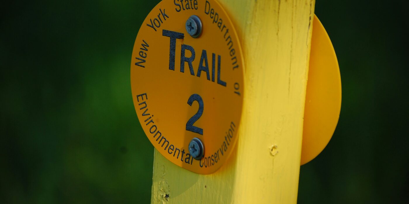
State and local trails
Each state forest or land management agency tends to have its own conventions. Some use shape-based systems (squares for easy trails, diamonds for difficult, triangles for technical), others color-based systems (green for hiking, blue for cross-country skiing, orange for biking, yellow for horseback). Local trail maps explain the conventions.
What Different Colors Often Mean
While there’s no universal color convention, some patterns appear across many trail systems:
White
Often associated with main or through-trails (the Appalachian Trail being the most prominent example). White is highly visible against most natural backgrounds and signals the primary route.
Blue
Often associated with side trails, spur trails, or alternative routes. On the Appalachian Trail specifically, blue blazes mark trails leading to shelters, water, or viewpoints off the main route.
Yellow
Often associated with cross-country ski trails in winter use systems. The color contrasts well with both summer green and winter white backgrounds.
Red
Often used for difficult or expert trails, particularly in ski areas and mountain biking systems where the red-trail convention has been imported from European difficulty rating. Some hiking systems use red for emergency or boundary markers.
Green
Often associated with easy trails in difficulty-graded systems, or with hiking-specific trails in multi-use areas.
Orange
Often used for mountain biking trails in shared-use forests, or for hunting/orange-tagged seasonal trails.
Black
Often used for expert-difficulty trails in mountain biking and skiing systems. Less common in pure hiking trail systems.
The color associations above are tendencies, not rules. Always check the local trail map or signage at the trailhead to confirm the system in use for your specific trail.
Shape and Symbol Conventions
In addition to color, marker shape often carries information:
Rectangle
The most common painted-blaze shape, used on the AT and many other trail systems. Standard 2×6 inch dimensions in many systems.
Diamond
Often used on metal or plastic logo markers attached to trees or posts. The Pacific Crest Trail’s diamond is one example.
Circle
Used in some state systems and for boundary or property markers. A circle might indicate a specific trail or a section maintained by a particular volunteer group.
Triangle
Used in some systems for technical or difficult trails. The Continental Divide Trail logo includes a triangle.
Custom logo
Established long trails (AT, PCT, CDT, John Muir Trail, Ice Age Trail, Pacific Northwest Trail, North Country Trail, Florida Trail, Arizona Trail, Pacific Northwest Trail) each have a custom logo used on official markers, in addition to or instead of generic shapes.
Cairns and Above-Treeline Marking
Above treeline (alpine zones, desert areas, tundra), painted blazes aren’t possible because there are no trees. The standard marker becomes the cairn: a deliberate pile of stones placed by trail maintainers to indicate the route.
Cairns vary in size and complexity. A minimal cairn is 3-5 stones stacked together, just enough to read as deliberately placed. Larger cairns (multiple feet tall, dozens of stones) are used in more critical locations like trail junctions, route changes, or above significant exposure.
Several rules apply to cairn use:
- Don’t build new cairns. Adding “decorative” cairns can create false trails that confuse later hikers. Leave No Trace principles specifically discourage recreational cairn-building.
- Don’t knock down established cairns. Trail-maintainers depend on them for navigation aid, and other hikers depend on them for route-finding.
- In low visibility (fog, snow, sandstorm), cairns may be your only navigation reference; learn to identify them confidently before relying on them.
Reading Markers in Low Visibility
Fog, heavy snowfall, dense rain, dust storms, and approaching dusk can all reduce visibility to the point where finding the next marker becomes the central challenge of the hike. Several strategies help.
Reliable navigation also depends on the right gear. Our guide to the best headlamps for hiking covers low-light options, and our roundup of the best hiking watches covers GPS-capable wrist navigation.
Slow down dramatically. Most marker-loss incidents happen when hikers continue moving forward expecting to spot the next marker. Stop at the current marker, scan systematically, and only move forward when you’ve identified the next one.
Scan in all directions. The next marker might not be directly ahead of you. Look 30 degrees to each side, up at typical blaze height (6-8 feet on trees), and down for cairns.
Backtrack rather than guess. If you can’t see a marker from where you are, return to the last marker you saw. Re-orient. Look for marker indications you might have missed (subtle path indications, blazed trees you didn’t notice, cairns in different positions).
Use map and compass. Marked trails are still trails on maps. If you’ve lost the marker system entirely, your map and compass (and GPS if you carry one) should still get you to known landmarks or trailheads.
Don’t continue if disoriented. Many serious wilderness rescue incidents start with hikers continuing past the point where they should have stopped to confirm their location. Stop, sit down, eat a snack, re-orient. Continued movement when lost almost always increases the difficulty of being found.
What Unmarked Trails Tell You
Some routes have no markers because they’re not officially maintained trails. These fall into several categories:
Bushwhack or off-trail routes. Found in wilderness areas where trail-marking would conflict with the area’s management goal. Requires map, compass, GPS, and route-finding skills.
Social trails. Paths worn by repeated use but not officially maintained. May follow desire lines that cut switchbacks (poor practice) or may connect features that the agency hasn’t formally included in the trail system. Following social trails should be done with caution since they may end abruptly, cross sensitive ecosystems, or lead away from established navigation.
Decommissioned trails. Old trails that have been retired and may have had their markers removed. Often visible on older maps but not current ones. Following these can lead into restoration areas or unstable terrain.
User-created routes. Routes used by climbers, hunters, or others that aren’t official hiking trails. May be challenging or technical without markers because their users are expected to navigate independently.
If a trail you’re following loses all markers and doesn’t appear on your map, you may have left an official trail without realizing it. Backtrack to your last marker confirmation and re-orient.
Marker Maintenance and Volunteer Trail Work
Trail markers don’t maintain themselves. Volunteer trail crews repaint blazes, replace metal markers, rebuild cairns, and clear vegetation that obscures markers. Most major trail systems depend heavily on volunteer maintenance through organizations like the Appalachian Trail Conservancy, the Pacific Crest Trail Association, the Continental Divide Trail Coalition, and state-level trail organizations.
If you encounter a missing or badly faded marker, several appropriate responses exist:
- Note the location and report it to the trail organization or land management agency
- Don’t paint your own marker; this conflicts with official maintenance and can create confusion
- Don’t move or modify existing markers
- Consider volunteering with a local trail crew if you use the trails regularly
Most trail organizations welcome volunteer help and have organized work days throughout the year.
Frequently Asked Questions
Why don’t all trails use the same marker system?
Many different organizations manage trails (federal agencies, state agencies, local land trusts, volunteer trail associations) and each developed its own conventions. Standardization across this many entities would require coordination that hasn’t happened historically.
What should I do if I think I’m following the wrong trail?
Stop. Check your map and any signage at the last junction. Compare the marker color and shape to what’s described in the trail guide. If you’ve been on the wrong trail, return to a confirmed location before continuing. Don’t continue forward hoping to figure it out later.
Are GPS apps replacing trail markers?
For navigation purposes, GPS apps like Gaia, CalTopo, and AllTrails are now widely used. However, GPS shouldn’t replace marker following on established trails, for several reasons: battery failure, GPS signal loss in deep canyons or under dense canopy, and the reality that markers also help identify trail intersections and features that GPS alone can miss. Use both.
Why are some blazes painted on rocks instead of trees?
Above treeline or in rocky terrain, rocks are the only available surface. Painted rocks are common on the AT through New England’s Whites and Mahoosucs, in much of the Sierra Nevada, and in alpine sections of many western trails.
What happens when a blazed tree dies or falls?
Trail maintainers repaint blazes on adjacent trees during normal maintenance cycles. In areas where many trees die at once (fire damage, beetle kill, storm damage), trail crews may need to do larger replacement projects. This is one of the major reasons trail-maintenance volunteer hours matter for the trail system as a whole.
Sources
- National Park Service. Hiking Safety and Trail Navigation. https://www.nps.gov/ (General reference on trail systems and navigation in NPS-managed lands.)